The Road to Zion (The National Park)
Note: The pictures from Bryce are finally in the post!
It seems like a really long time since I’ve posted anything on the blog. Jess has been taking care of the sporadic kiddo updates lately, and I’ve had a bit of a free pass. The past week I’ve been out here in the desert West while Jess and the kids have been visiting old friends, grandparents, and haunts in Ohio. Originally Jess was just going to spend a few days riding motorcycles with her friend Elaina from high school, but the trip ballooned into a week-long affair with the majority of both weekends as well. Since Grandma and Grandpa were happy (before the visit at least) to watch Phoebe and Benjamin while Jess was off riding, that left me with a week for a little vacation as well. Since I wanted to do something that incorporated a bunch of cycling, I called Elijah to see if he was game for a trip of sorts. After a bit of discussion over several cups of coffee (but very little formal planning) we decided to do some bike trekking around the deserts of Southwest Utah. As the trip got closer, we revised our plans a bit (see below for some of the rationale) and decided to just drive between the parks and ride through all of them.
While the trip proper for us started Saturday morning, the real fun got going on Thursday when I dropped off the car for some much-needed brake work. I had all of the parts (pads and rotors) sitting in the garage for the rear brakes on the Subaru, but after jacking up the car and taking off the wheels, I couldn’t get the caliper bolts to budge. Part of the issue was due to a funky hole in the control arm that you have to use to access the bolts, but the real issue was that I clearly needed an impact driver and a universal joint for my socket. Of course, once at the dealership, what was supposed to be a $50, half-day job quickly grew into a much more expensive multi-day affair. I hate paying for car maintenance, but I was glad to have all of the work done before driving to Zion and back, and the car is much quieter now that the balky wheel bearing has been replaced. Since we have just the one car, I had to get a free rental for a day from Enterprise, so that meant a bunch of driving around and coordinating schedules on Thursday (and stopping by the dealership to retrieve car seats for the kids). In principle the car was supposed to be done by noon, but of course it wasn’t quite ready to go in time for me to return the rental car and get the Subaru before I had to take Jess and the kids to the airport, so instead I had to drive out to the airport in the rental car and race back to the dealership before the closed. I made it with about 30 minutes to spare; whew! Let the vacation begin.
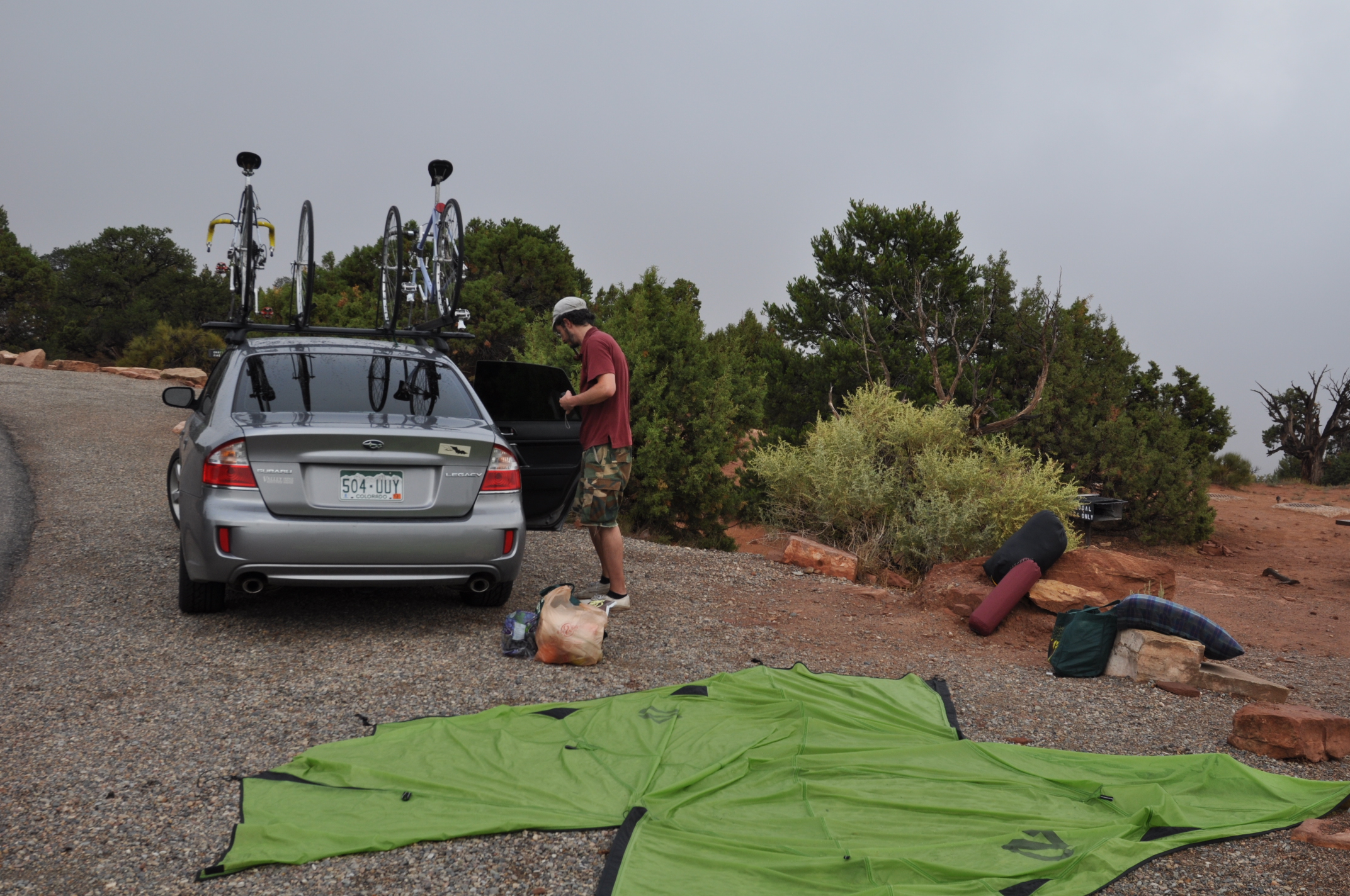
I met Elijah the next morning at a coffee shop and we did a little last-minute grocery and beer shopping (Utah is not a beer-connoisseur-friendly state in the least). Next we swung by a small bike swap in Boulder before stopping by Elijah’s place to pick up the rest of his gear. It was much later (maybe 2:00) than I was planning before we actually left Boulder, but as we were planning to spend the night at the Colorado National Monument (about 4 hours of driving) it really wasn’t a big deal. We stopped for coffee in Rifle and arrived near Fruita at about 6:00. We had just enough time to get up to the top of the monument, set up camp, and make dinner (spaghetti take 1) before the clouds and rain came in. The rain was fairly gentle, but it persisted throughout the night and much of the following morning. We ended up stuffing the wet tent into a reusable grocery bag in order to transport it to the next site as it was too wet for the stuff sack.
The following morning we had a breakfast of instant oatmeal and packed up camp. We almost got everything dried out between rain outbursts, but a sudden sprinkle soaked the tent at the last minute. Our rough plan for the week was to travel across the Southern reaches of Utah (pretty much an unbroken chain of state and national parks and monuments with a bit of BLM and designated recreation area (think Lake Powell) thrown in for good measure). We were planning to spend about a day/night each at the Colorado National Monument and Capitol Reef National Park with two days apiece at Bryce Canyon and Zion National Parks. We had really good fortune with sites (the Colorado National Monument was nearly empty when we arrived). The only place where we couldn’t camp was Zion on the first night. Who says you can’t be spontaneous any more!


After breakfast, we headed over to the visitor’s center to get our learning on. They’ve improved the museum a bit since the last time I visited, and they have a lot of cute kid stuff that I’m sure I never noticed before. By the time we were ready to hit the road, the clouds had parted, so we adapted our plans and got changed for a ride on the scenic drive. We wanted to get on the road for the drive to Capitol Reef, so we only rode from the visitor’s center to about the high point and back. It was a pretty enjoyable ride with awesome scenery all the way. We even checked out a little dirt road that went into the McInnis Canyons National Conservation Area, but it was a bit soft for the road bikes.
Back in the car, we drove into Utah and along the scenic highway 128 to Moab for a short pit stop. I had a heck of a time finding a stamp for a postcard to Jess and the kids, and it was even more frustrating to get a decent WiFi connection so that I could look up the address in Ohio (one piece of useful info I forgot to bring with me). We also picked up a few more provisions and stopped in a bookstore with perhaps the world’s largest collection of signed copies of Desert Solitaire. As I’ve noticed in the past, the desert is full of Germans. There is no real value to this observation except that it caused us to utter fahrvergnügen (driving enjoyment; thank you Volkswagen) repeatedly through the trip. I should point out that there were also a lot of French tourists in Bryce and Zion. For some reason, the Germans seemed to prefer RVs while the French slept in tents. Maybe there is a sociology or anthropology monograph to be written.
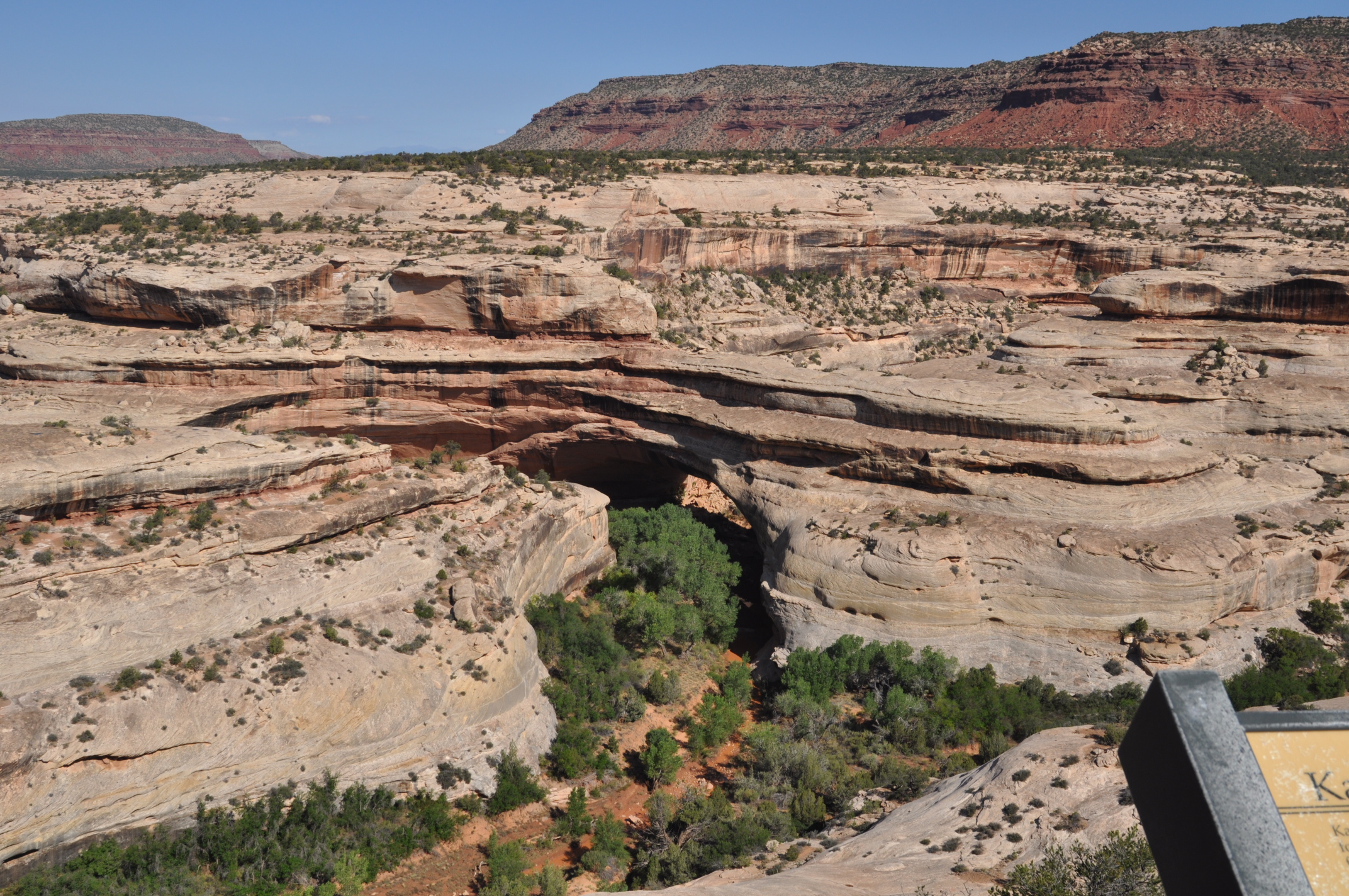
As we were driving towards Capitol Reef it again started to rain heavily. This was turning into the wettest trip to the desert in my life! We were informed repeatedly throughout the trip by rangers and locals alike that it was the monsoon season. We passed a lonely-looking solo bike trekker in the vast emptiness west of Blanding at about the time we realized that we weren’t going to make it to Capitol Reef by dark, so we adjusted our plans to camp at Natural Bridges National Monument (another “free” entry thanks to our recently acquired interagency park pass). We set up camp and went for a quick ride around the 10-mile scenic loop, but we had to abort about 1/3 of the way around the loop due to rapidly encroaching darkness. We got back to the campsite just as things were turning black and started on some dinner. After dinner, the sky really cleared up and we enjoyed some great views of the Milky Way. Natural Bridges is in the absolute middle of nowhere and therefore is a phenomenal dark sky site. It turns out that the monument (along with most of the other places we visited) hosts a number of astronomy events throughout the year. We were about a month early for the festivities at Natural Bridges.
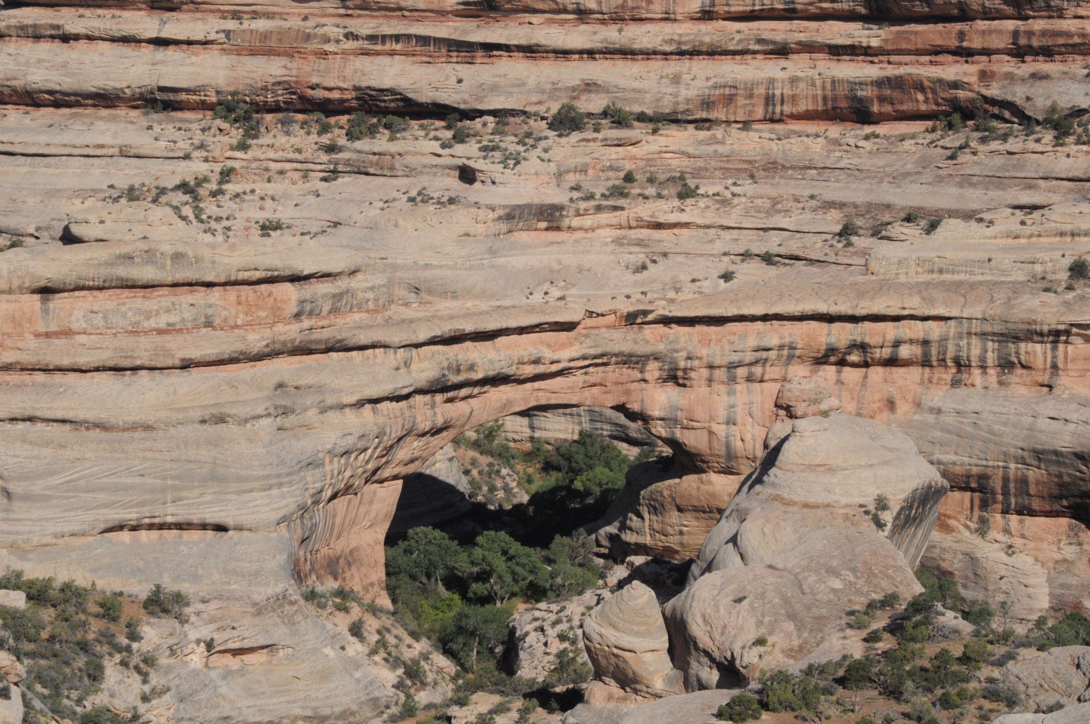
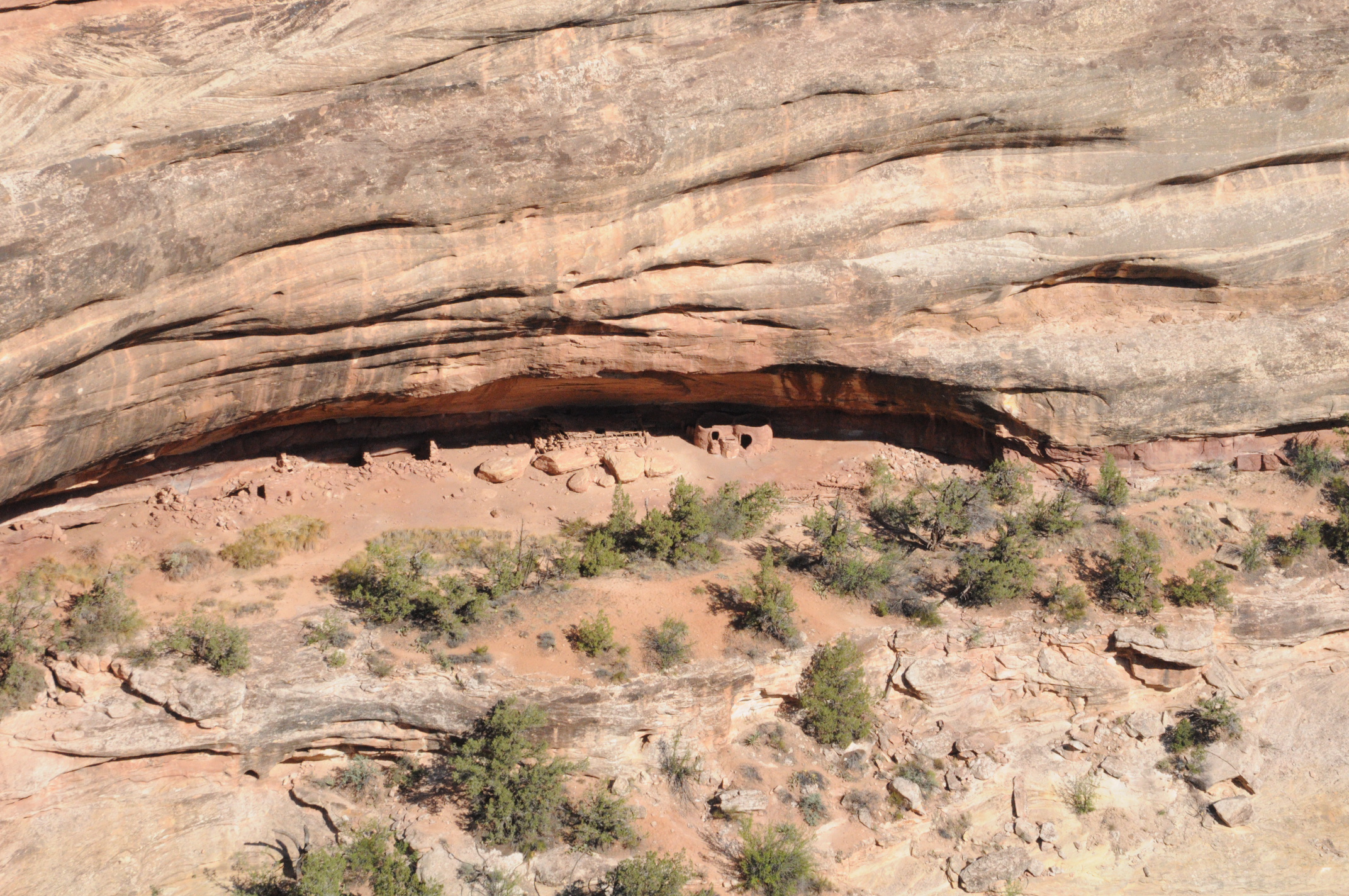
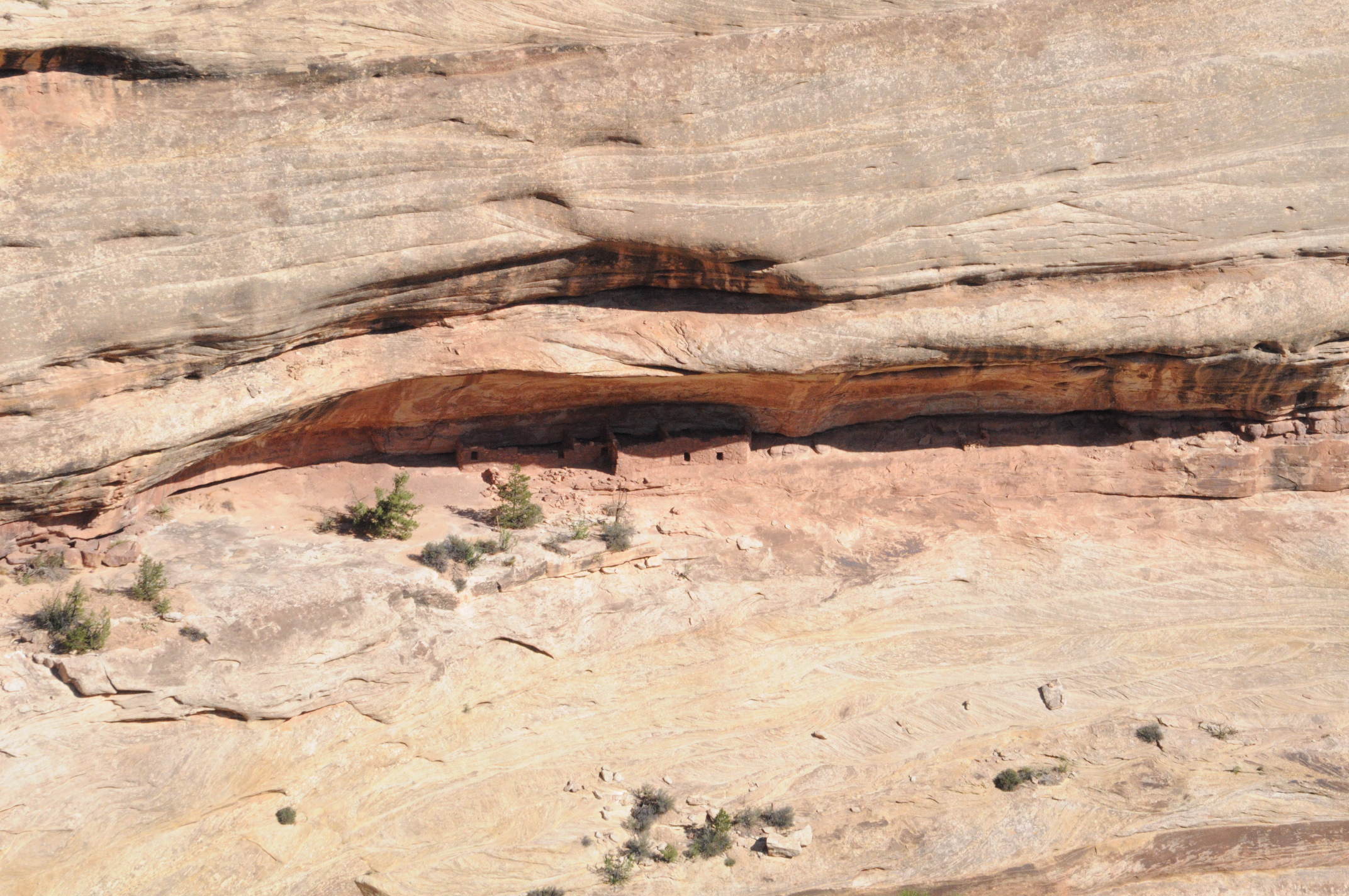
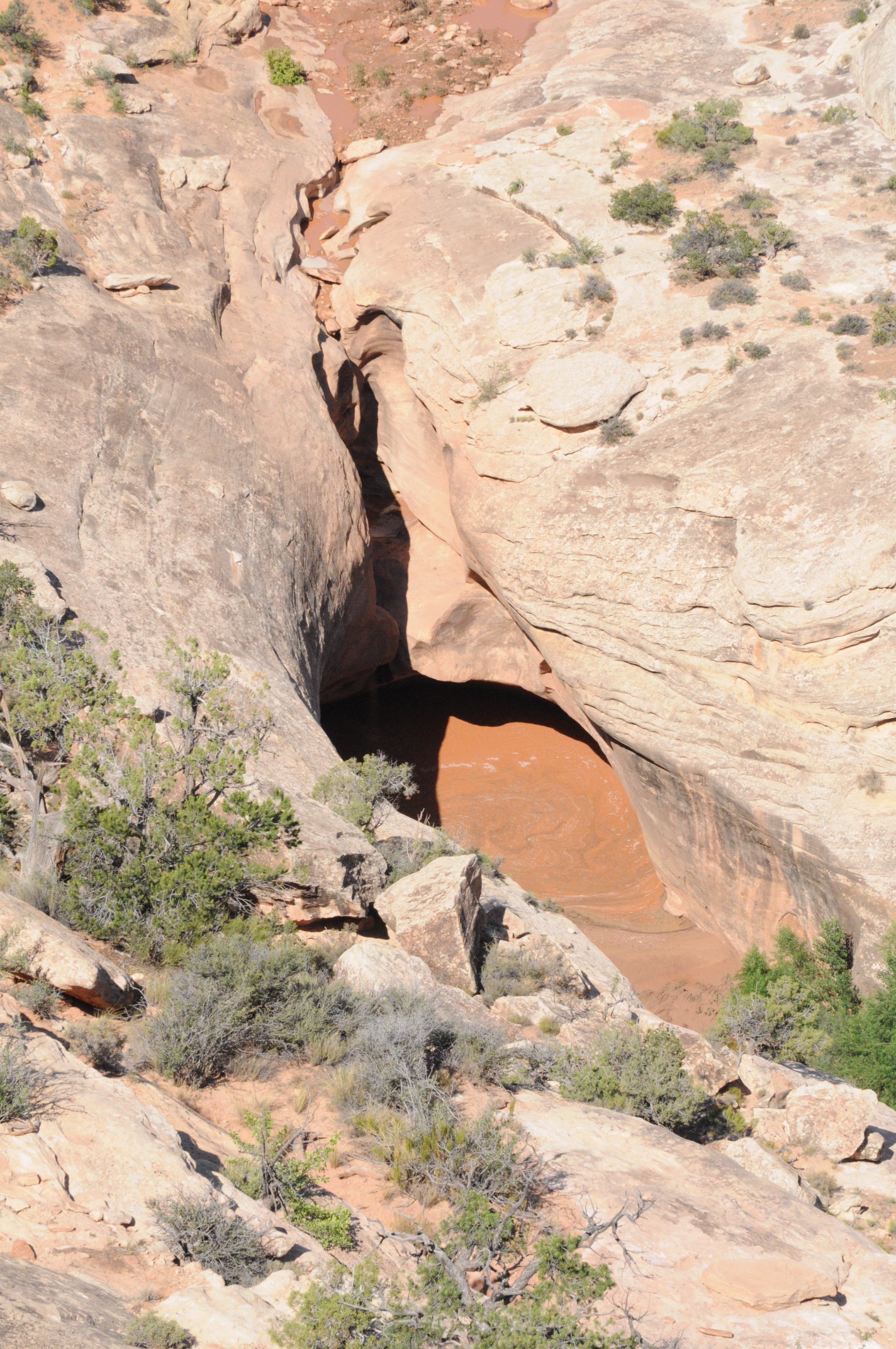
The next morning, we ate breakfast and packed up our gear before heading out for a proper ride around the scenic drive. We took our cameras this time and got pictures of the 3 big named natural bridges and some really cool Anasazi ruins tucked under part of the canyon rim. It turns out that the difference between a bridge and an arch boils down to how it’s formed. The bridges are carved out by water with the arches being caused by wind erosion. There were a few other cars and visitors, but we just about had the place to ourselves. Biking around the national parks was turning out to be a pretty enjoyable way of seeing the scenery. After a stop in the visitor’s center to fill up our water containers (never pass up water in the desert they say) and have a chat with the rangers, we were back on the road to Capitol Reef National Park.
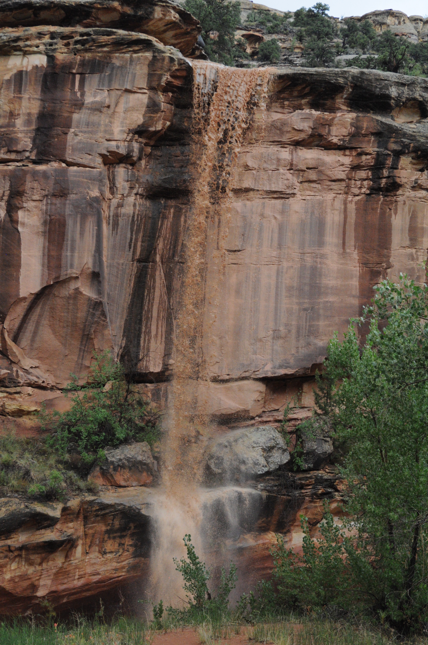
The drive from Natural Bridges to Capitol Reef isn’t terribly long, but it is remote. You don’t really go through much by way of towns, and services are almost unheard of. It’s a good thing we packed the espresso machine! We did cruise through a bunch of spectacular canyon country, and we even crossed the tip of Lake Powell (really just the Colorado River at that point) on a nice bridge in the middle of nowhere. Along the road we passed a quartet of bike trekkers riding two upright/recumbent tandems with fully loaded paniers. It looked like slow going for sure. We refueled in a small town called Hanksville that seems to exist solely to provide gas to monster trucks pulling boats down to Lake Powell. There were also a few house boats on blocks for sale if anyone is interested. From Hanksville, it’s a fairly short drive to Capitol Reef. Just as we were entering the park it started to rain biblically. I thought the road could wash out or become impassable at any minute, but we kept plodding along. At some point we forded water at least a foot deep for around 100 feet. We were mighty glad to make it through that! As quickly as the storm cropped up, it departed, and we were treated to spectacular muddy waterfalls from the cliffs.
When we finally made it to the visitor’s center, we could see from the radar screen that we were in a sort of eye of the storm, so naturally we decided it was a good time to ride the scenic drive through the park. This was a fantastic ride (highly recommended) with very low traffic. The drive proper is about 10 miles one way (no loop sadly) with the last couple of miles being on dirt/rock. It’s mostly uphill on the way out, but rolling. We made it nearly to the end (about half of the dirt road) before Elijah nearly ate it in some soft sand. We turned back and raced back to the visitor’s center to roof the bikes.
In addition to being a gorgeous track of countryside, Capitol Reef was also once settled by Mormons who planted fruit trees in the amazingly lush inner valley. In what’s got to be a unique case, the park continues to harvest fruit from the trees and offers a variety of traditional preserves and pies for sale from one of the historic houses in the valley. We picked up some of both, and the fresh pie was an amazing dessert that night. We got back in the car and made haste towards Bryce. Along the way, we stopped in Escalante to get a cup of coffee for the road, but the waitress must have missed the “to-go” part as she served the espresso drinks in mugs. We ended up chatting with what must be one of the J-E-T-S biggest fans (from Connecticut) as he struggled through the process of ordering a beer in Utah. Back on the road, we arrived in Bryce a bit before dark and got what I think was the actual last campsite in the park. For some reason it seemed to be the only site in the park that was not permitted to have a campfire. We quaffed a few beers, enjoyed some more killer views of the Milky Way, and went to sleep.
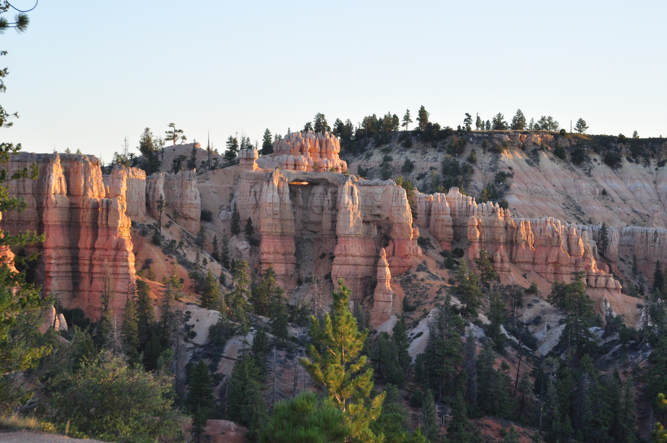
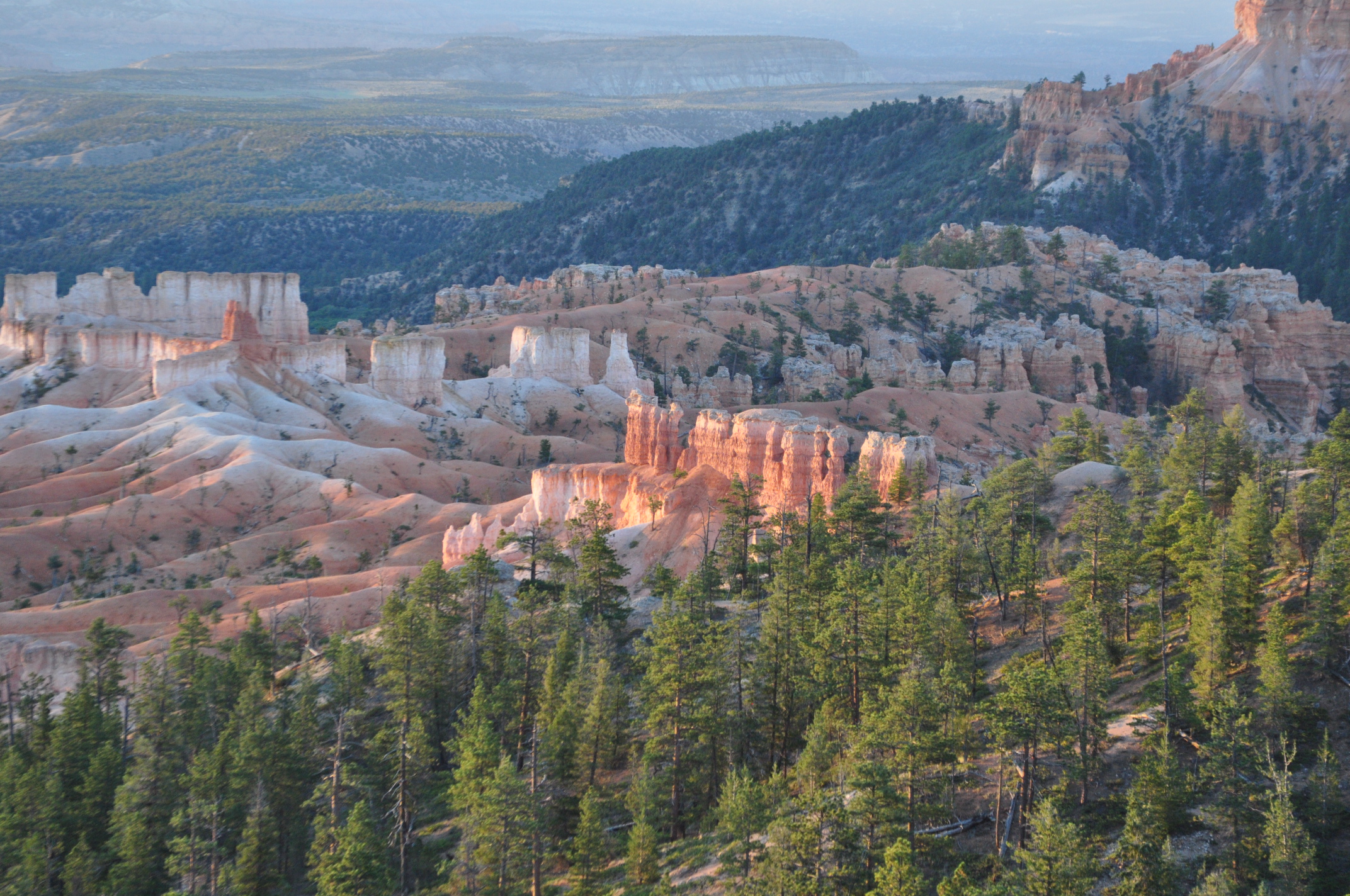
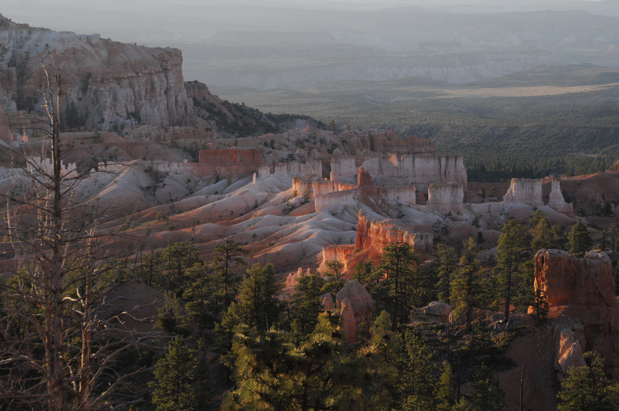
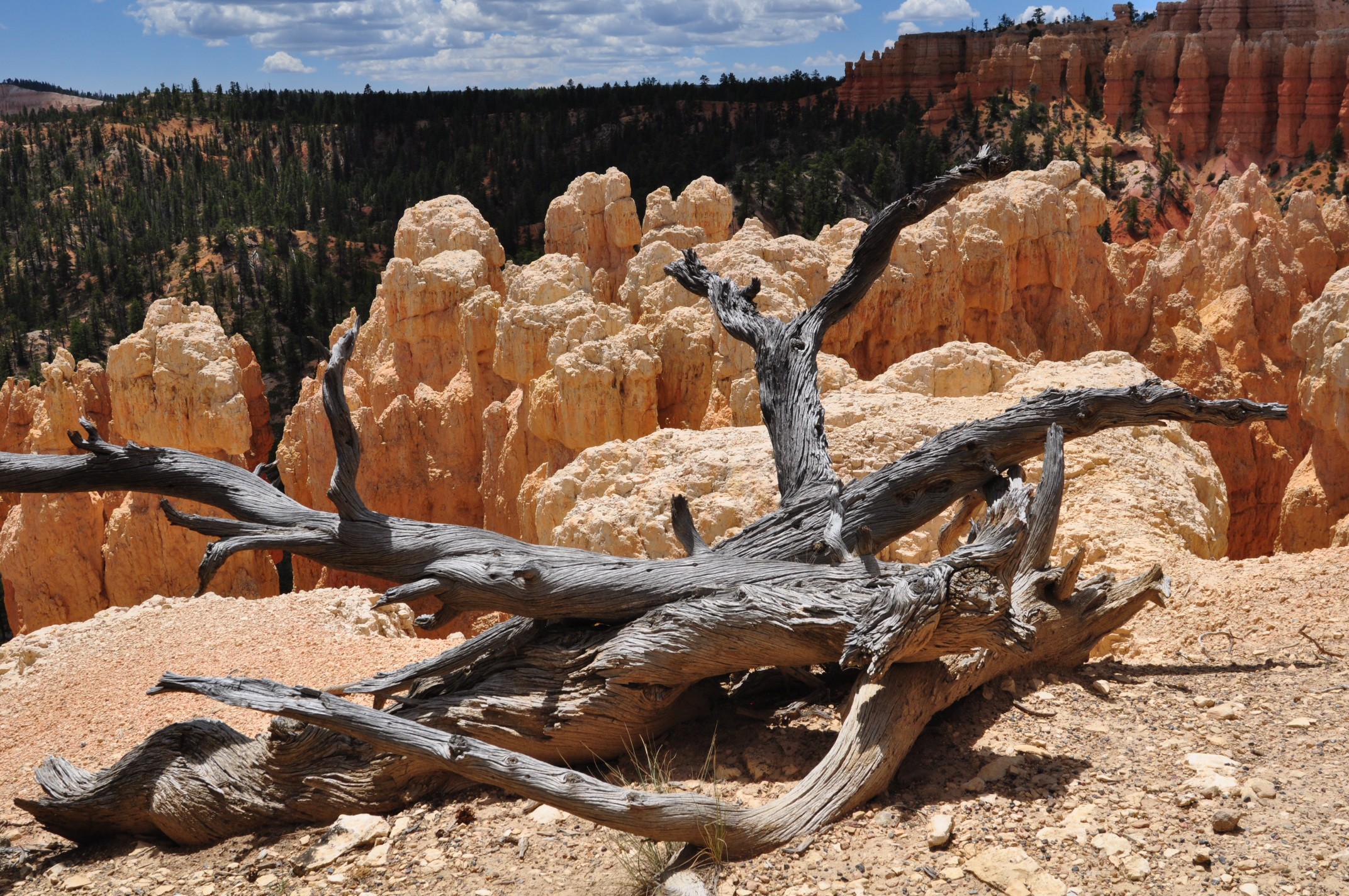
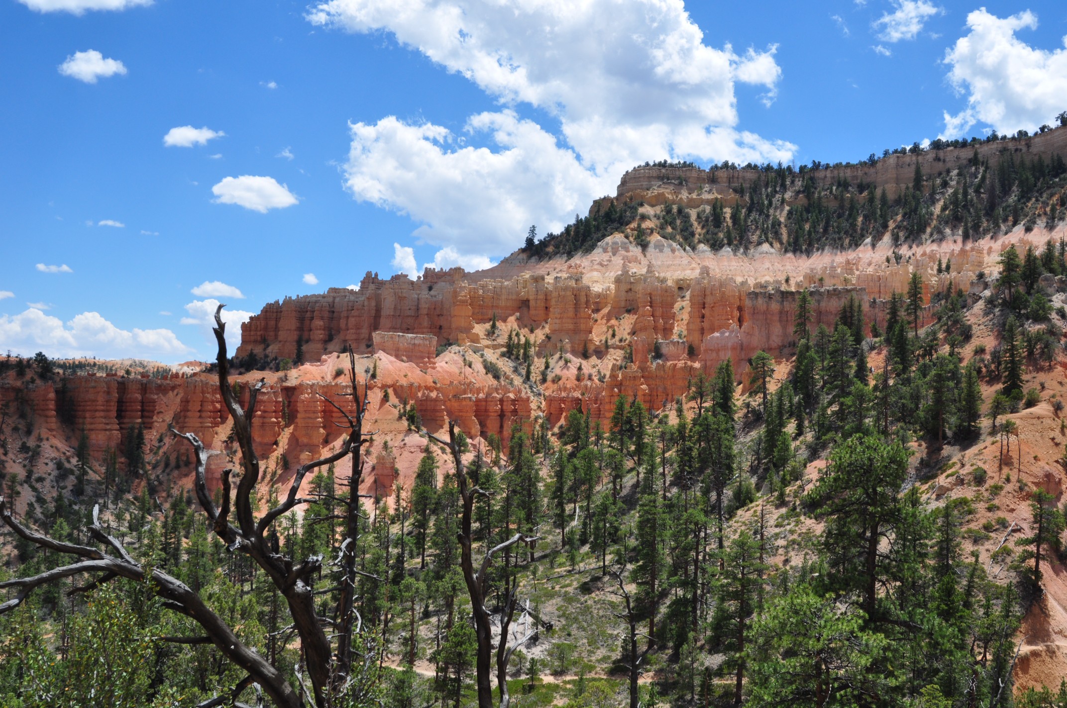
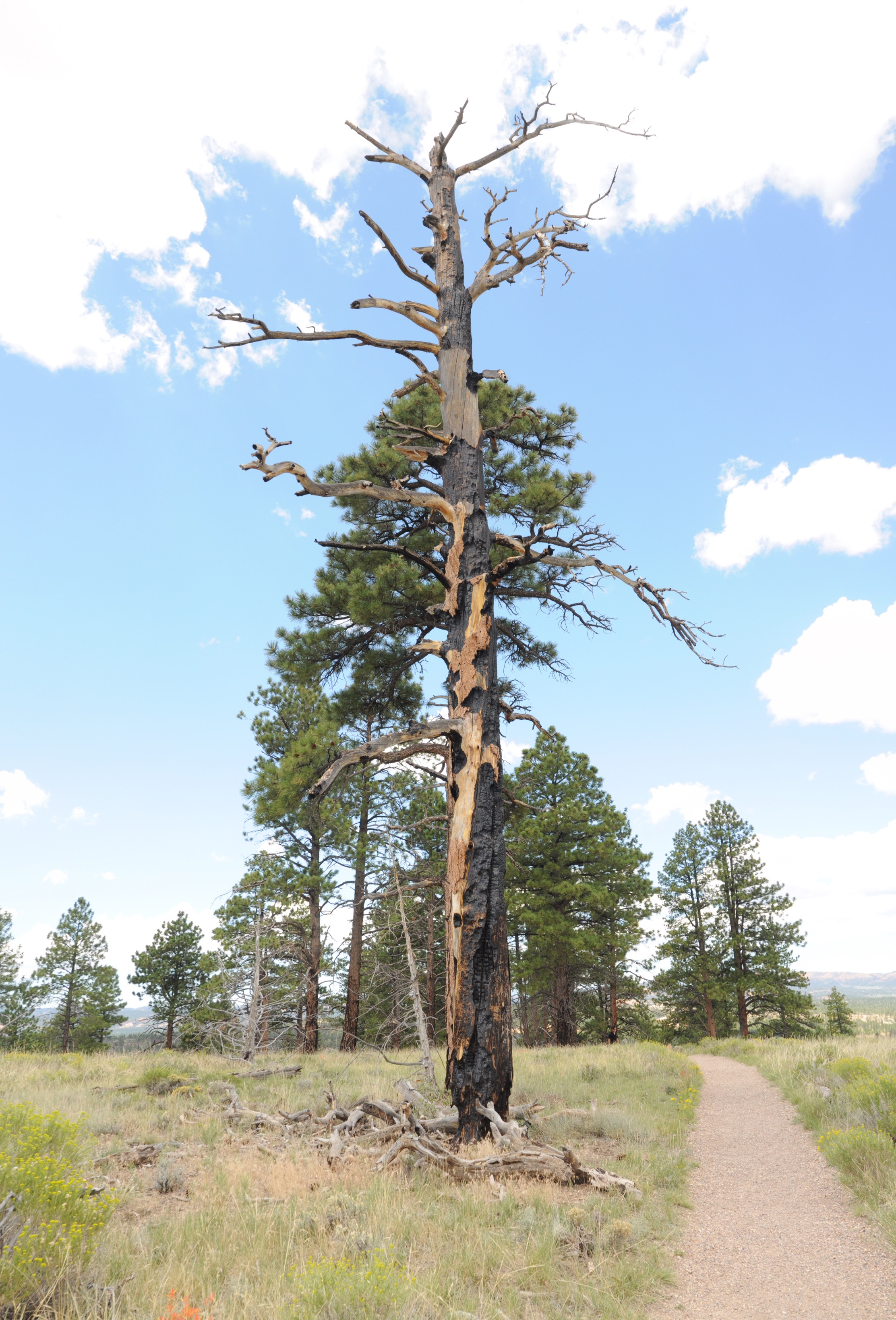
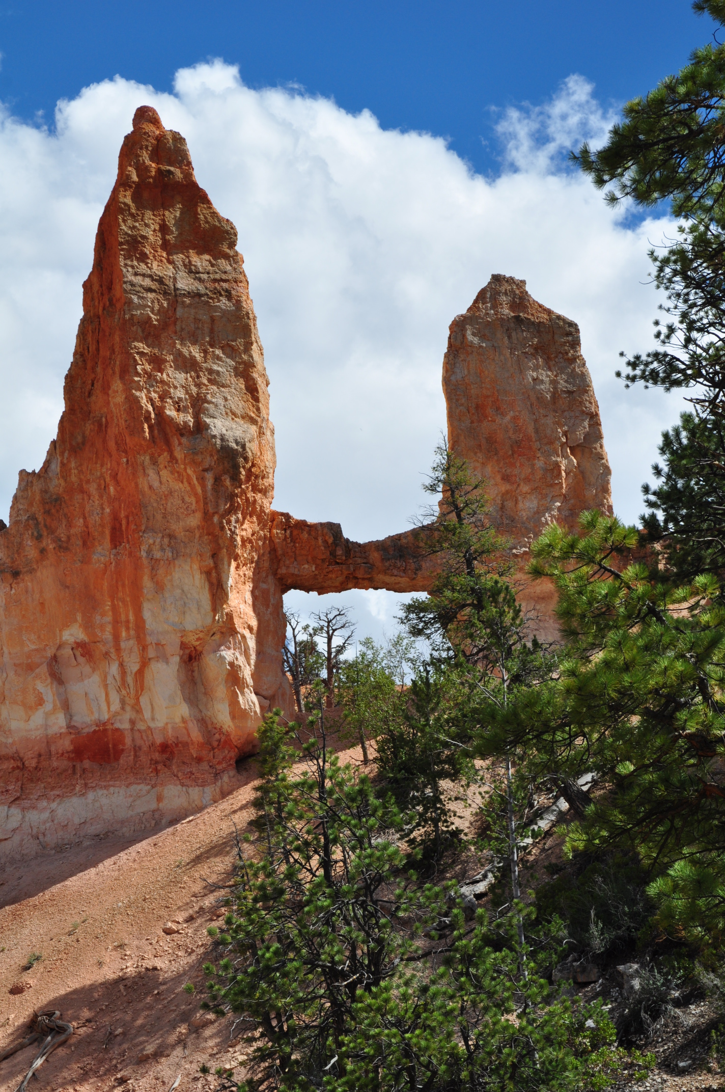
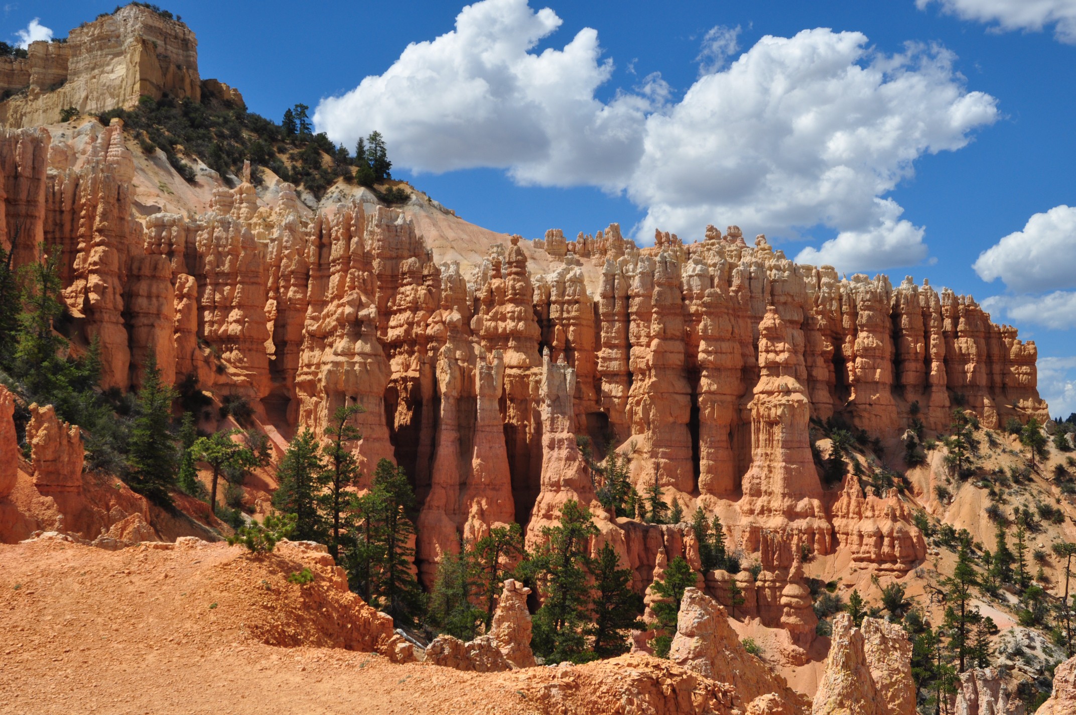
The next morning we got up early-ish and hiked a short distance from the campsite towards Sunrise Point along the rim trail to get some images of sunrise over the canyon. I hadn’t really gotten a view of the canyon and the iconic hoodoos yet. They are amazing. After taking a lot of pictures, we wandered over to the lodge for a breakfast buffet and checked out the camp store. When we got back to the campsite, there were a lot of empty sites, so we relocated to one where we could have a fire and cook our brats. It was a short move, so we just carried the tent fully assembled with sleeping bags and all. After completing the big move, we headed back to the camp store where we stocked up on ice (block 3 for the trip) and firewood and enjoyed our first shower in days. When you ride around in the desert heat day after day you sure get stinky! In the shower house they have what might be the world’s most poorly written sign. Nobody (regardless of native language) seemed to understand what it was trying to say.


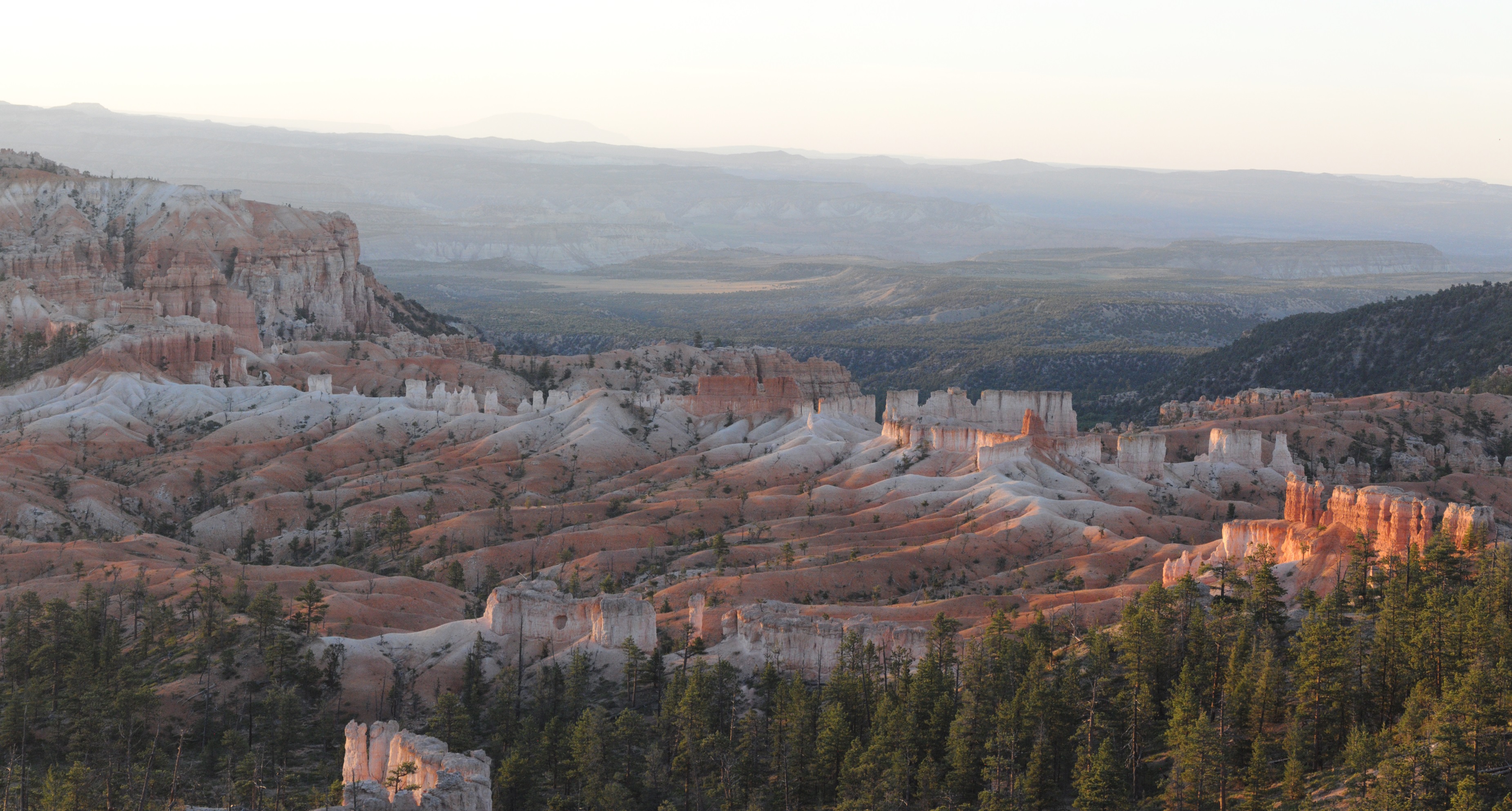

Back at camp and refreshed we set out on one of Bryce’s most strenuous hikes, the Fairyland Loop. I pulled on the hiking boots thinking they’d offer some extra support for my still rehabbing ankle, but that turned out to be a huge mistake. Instead of ankle problems (initially) I suffered horrible toe bang. That eventually lead to foot pain, knee, apin, and thing pain. I haven’t had trouble with my boots before, so I’m not sure what caused the problem, but it turned what should have been an awesome hike into a suffer fest. Still, it was gorgeous, and I did get a lot of great pictures. Most important was what I didn’t get (but feared) throughout most of the hike. Blisters!

That night we had an awesome treat. A talk (a bit rough around the edges) about astronomy in the campground amphitheater with one of the park rangers and some stargazing through a variety of telescopes by the visitor’s center. I knew that they had astronomy events on Tuesdays, but wasn’t sure in advance what they were going to be, and there was no way to know if it would be clear, but we were luck on both accounts. We enjoyed the talk with beer in hand then made the short walk to the stargazing. We got to look at some binary stars, an open cluster, Saturn (with Titan and a couple other moons visible as well), and a lovely planetary nebula in Sagittarius through a 24″ truss-style Dobsonian telescope. Thoroughly tired, we headed back to the campground and went to sleep.
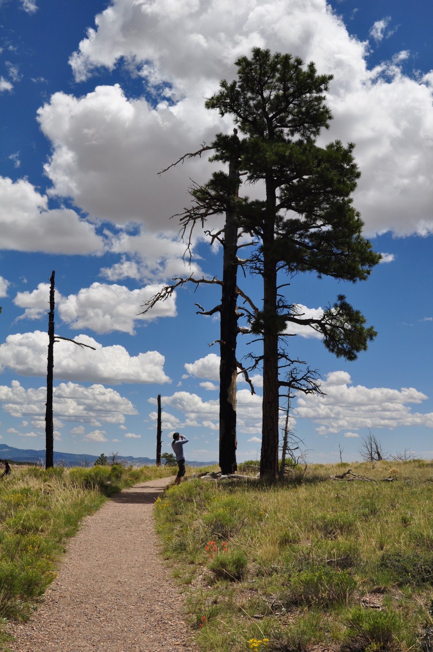
Wednesday morning was another beautiful day. We slept in a bit (so we missed a 2nd crack at sunrise photos of Bryce) and cooked breakfast before packing everything up. Rather than getting right on the road to Zion (which we knew put our odds of getting a campsite in jeopardy) we dropped the car off at the campground store and switched to bikes for a ride out to Rainbow Point at the far end of the park. It’s about 34 miles round trip with a little over 1100′ of climbing on the way out. Much of the climbing was mellow, but there were a few steep pitches, and the big rollers near the end were extra tiring. Still, even with a lot more traffic than the previous park rides (cars are allowed throughout Bryce) it was very nice. There weren’t any other cyclists on the scenic drive in Bryce Canyon. We didn’t bring the cameras on this ride, so there aren’t any pictures, but the views were excellent. You could see a number of hills up above the hoodoos of Bryce in the distance. And on the way out of the upper parking lot, I had my only accident of the trip, an ultra-low speed near collision with Elijah’s rear wheel that sent me elbow first into the tarmac. I got a wee bit bloody and managed to bend up my water bottle cage a bit, but there was no real damage aside from a bit of a blow to the pride. Several automobile enthusiasts offered band-aids and the like. They were very kind, but I just wanted to get out of there.
After riding for a few hours and grabbing another shower, we didn’t roll into Zion until around 6:00. The traffic around the Zion-Mt. Carmel tunnel was pretty bad. At times it resembled traffic around the Eisenhower Tunnel in Colorado on I-70. Right after we entered the upper reaches of the park (we approached from the east) we passed another pair of bike trekkers. We knew from earlier research that bikes weren’t allowed in the tunnel (The NPS actually recommends waiting for a driver willing to allow you to hitch a ride with them through the tunnel), so we wondered how they’d eventually get through. This was a small part of our decision not to go the touring route after all.
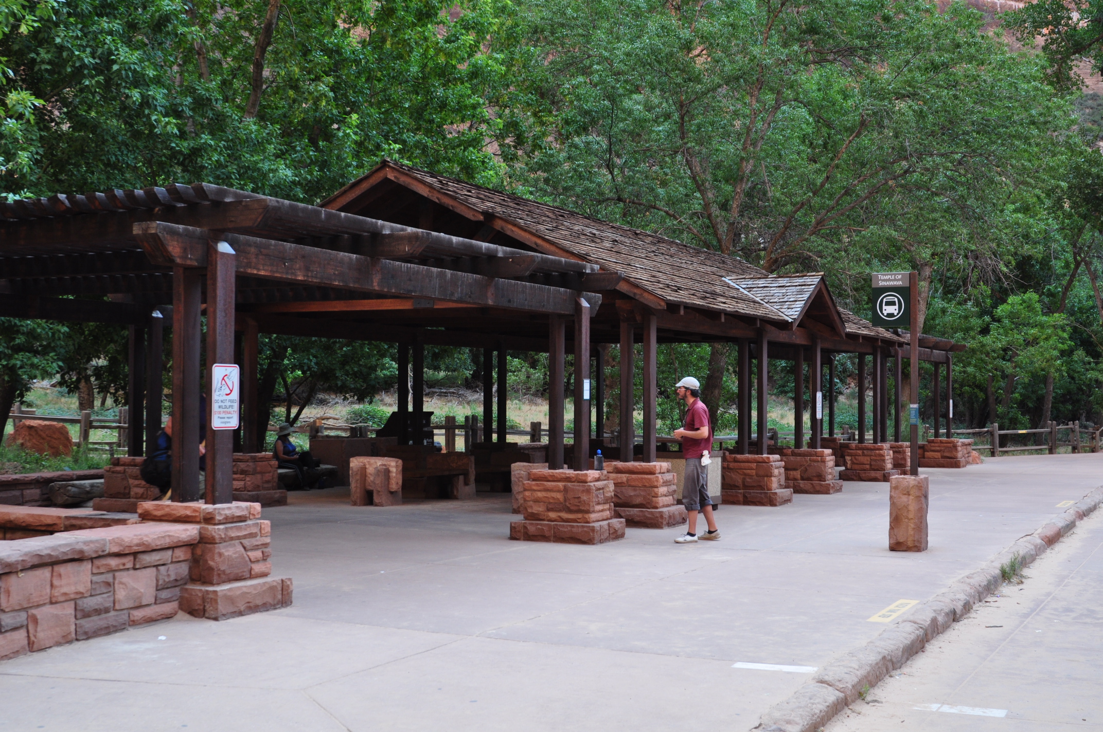
Needless to say, all of the campsites were taken by the time we got through the tunnel and down to the bottom of the park. We asked about alternatives at the visitor’s center and were given the 411 on some private campgrounds in the vicinity and rough directions regarding at-large camping in nearby BLM lands. We settled on a very close private campground that was in the end more-or-less terrible, but for a single night it was at least convenient. We got up early, made breakfast, hastily packed, and moved into Zion ASAP. Back in the park campground we bumped into one of the bike trekkers (I think his name was Danny). He and his partner didn’t get a site the previous night either. They had to wait over 2 hours to eventually get a ride through the tunnel. They were lucky that a local came through the other direction with a truck, saw them waiting, went back, and gave them a lift. The park service must have taken pity on them as well, because they got to spend the night on the lawn in front of the ranger HQ. When we met them, they were shuttling their gear from the lawn to new campsight. We tried to hook up with them for a ride later that night, but they weren’t at their site when we rolled through. Nevertheless we’d run into them again the next afternoon on one of the trails in the canyon. Turns out they were out for a few weeks from Maryland. It was enough of a trip to make even us a bit jealous!
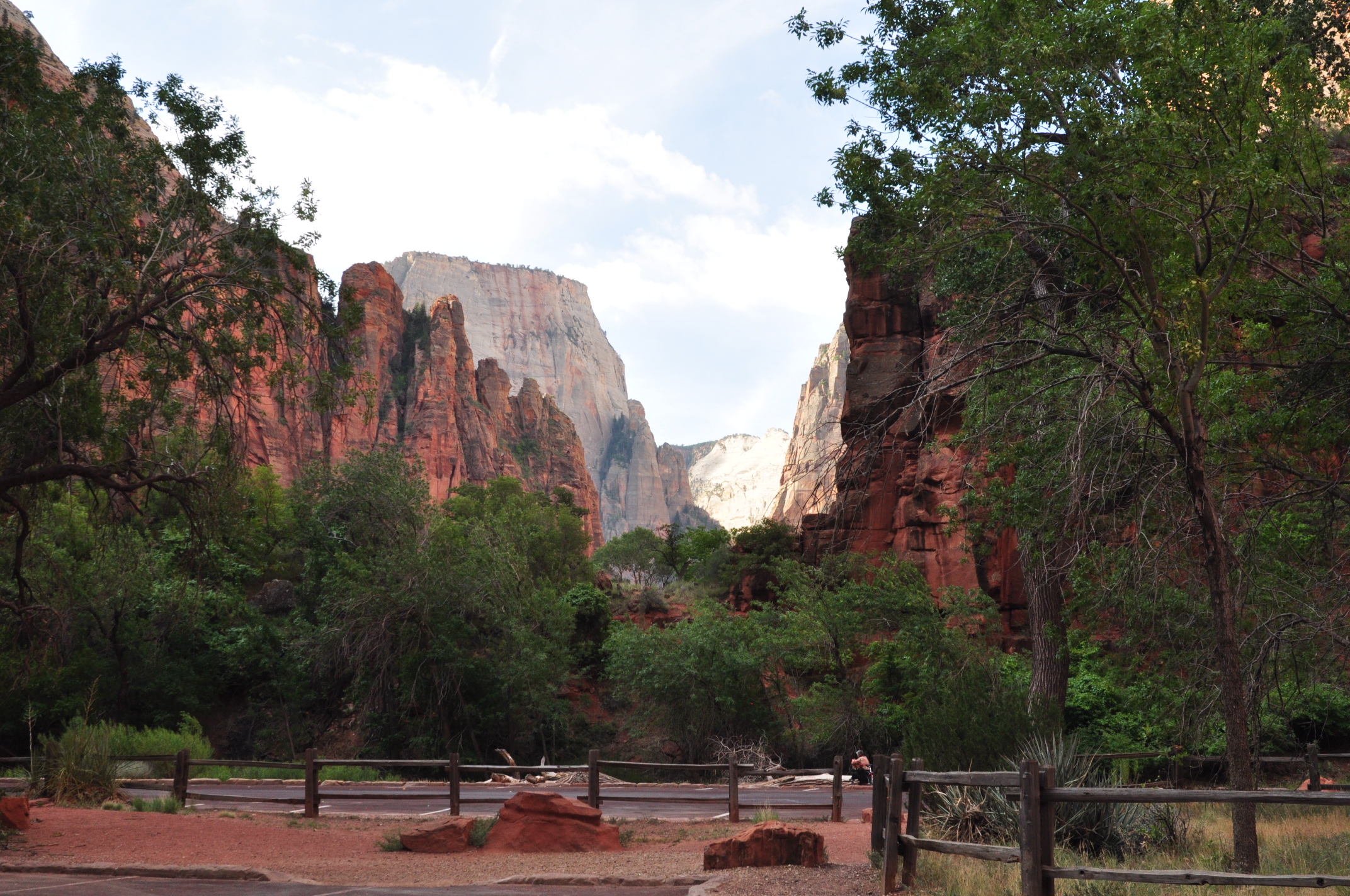
After getting camp more-or-less set up we rode up to the end of the scenic drive and took the River Walk trail out to the start of the Narrows and back. It was a nice easy 2 mile round-trip hike with a lot of people. The ride up the canyon was awesome, as with Zion’s requirement to ride the shuttle (or a bike) there was nearly no traffic on the road. After the short hike, we rode back down the canyon and stopped for another hike to the Emerald Pools. The lower pool is wheel-chair accessible (but it would be a heck of a ride if you lost control on the slopes), but the excursion to the upper and middle pools is quite a bit more rough. Still, they combine to another short hike in the park. Sadly I didn’t bring the camera on the ride (opting for a change of shoes instead), so I don’t have any pictures of either destination. We also stopped for a little stroll around the lodge, but we decided to retreat when it started raining. That decision might have been a bit hasty as the rain was brief and gentle, but the clouds seemed to indicate a more severe storm was possible.
After the hiking, we explored the town (Springdale) right outside the Western entrance of Zion and got some dinner. I also got some beta for a potential return trip in the fall/winter to do some mountain biking at Goosberry Mesa from a friendly and enthusiastic bike shop owner, and we asked questions about some of the other skinny tire rides in the area. The previous morning we ran out of gas for the stove, so we also picked up some camp gas from one of the provision shops and restocked our food at the little grocery store. It was also time for another block of ice; man, I need to replace this cooler! After dinner we got another cup of coffee, and that put Elijah into the mood for an evening ride. We got back to the campground and saddled up with the goal of finding the Smithsonian Buttes Scenic Backroad and the ghost town of Grafton. On the way out, we missed the turn (not much signage) and went a few miles too far before I determined that we’d definitely missed something. After a brief discussion, we decided to head back to Zion, but on the way we spotted a sign for Grafton (yippie!). The road took us over a little bridge and past an amateur photo shoot in the setting sun. A little ways later, we found the beginning of the scenic road and the branch to Grafton. We made it to within a couple of miles of the ghost town before turning back due to another bout of impeding darkness. So we beat a trail back to town, grabbed a soda, and made it to camp just before dark. We got to go through the entrance station on bike for the only time this trip. It was uneventful.
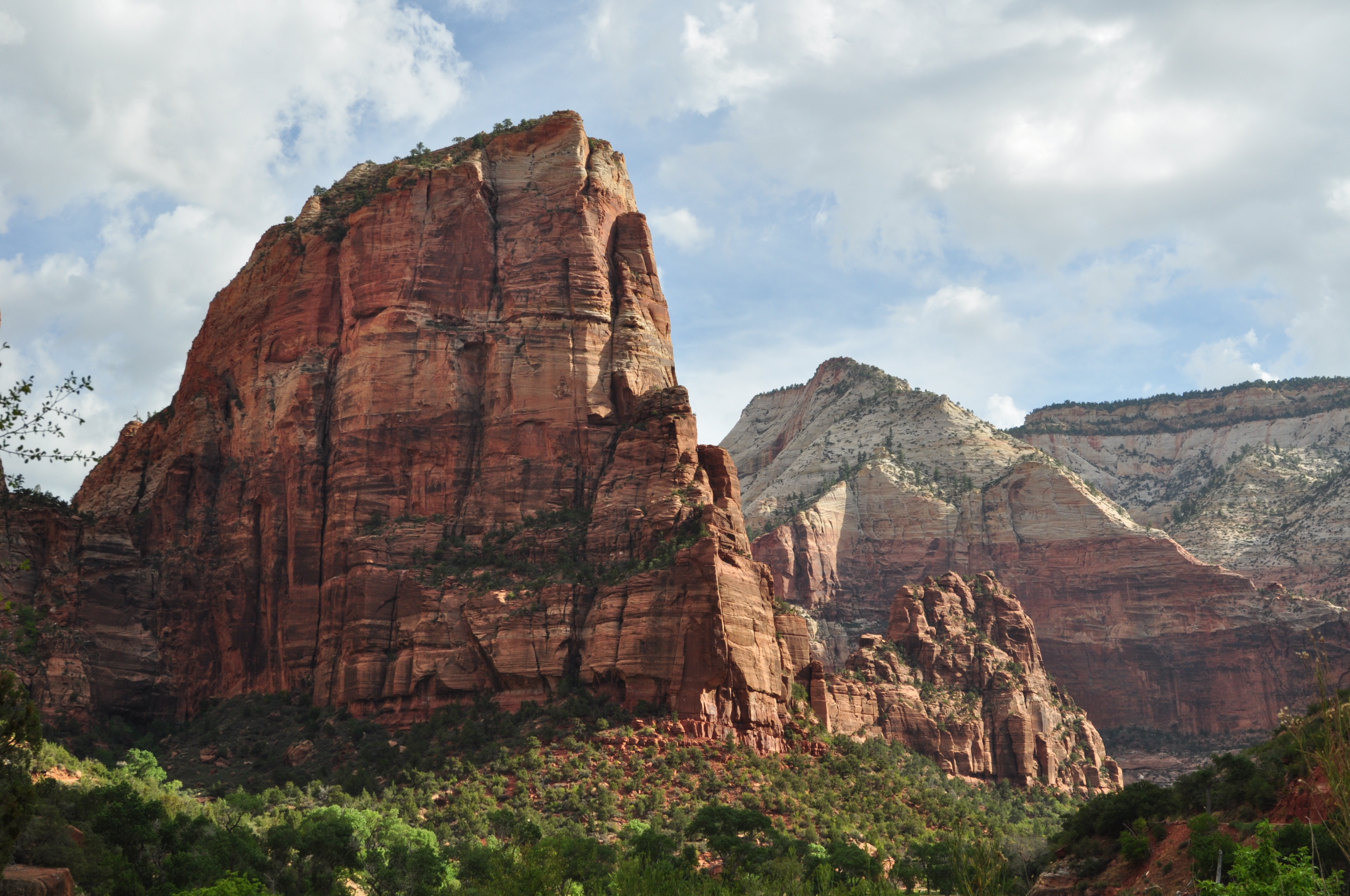
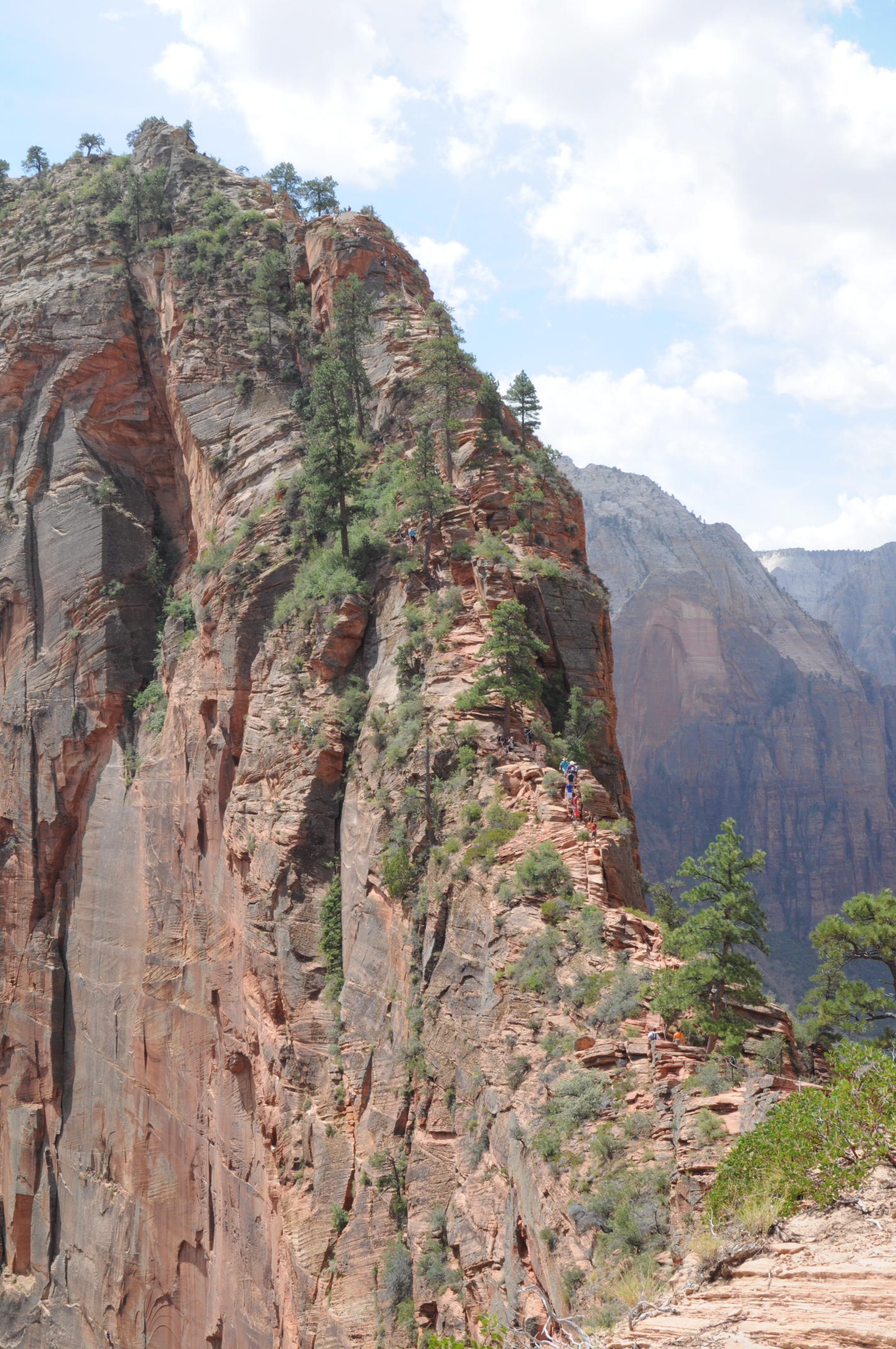
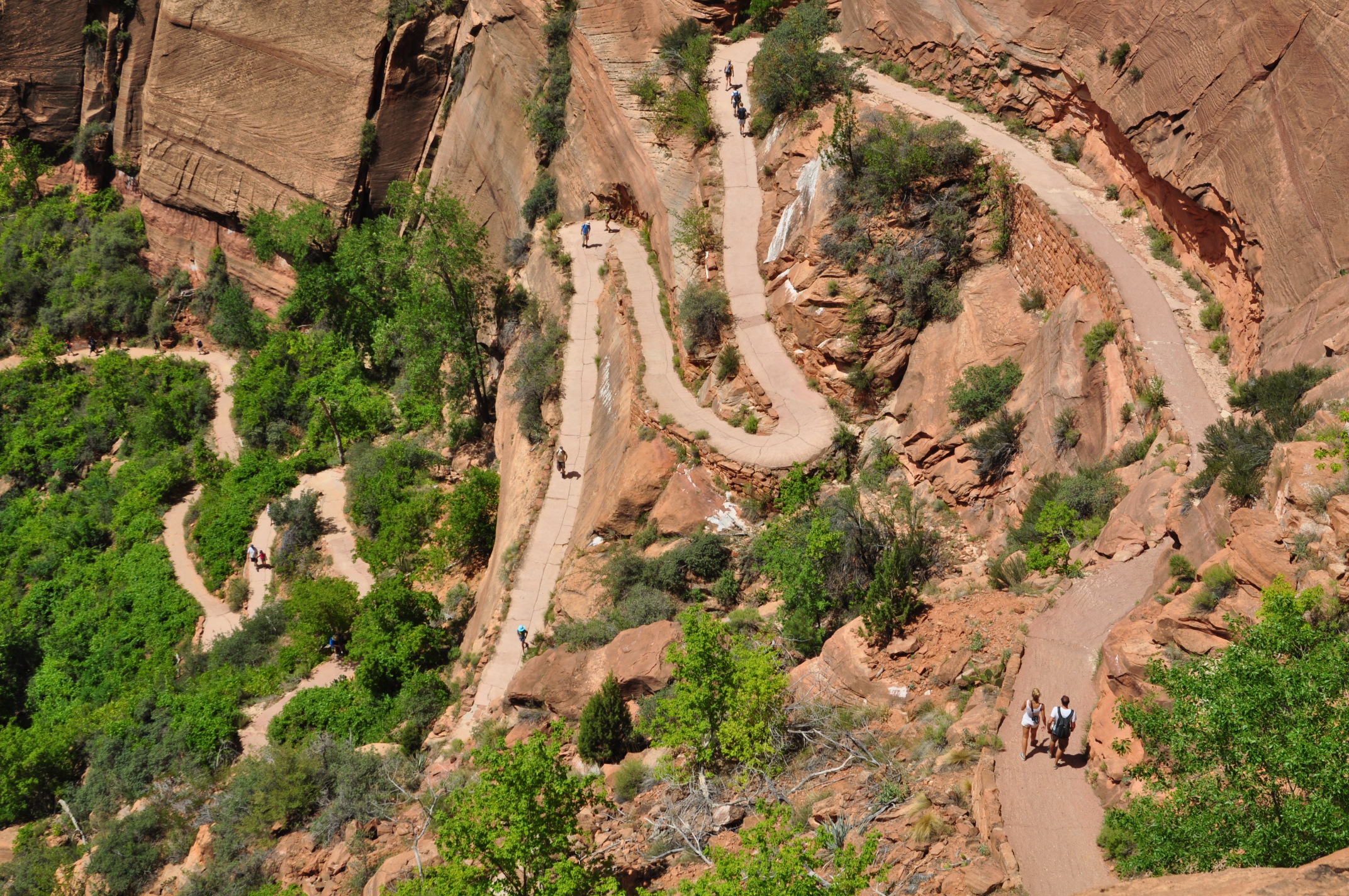
The next morning was Friday and the last day in the park before heading home. We got up early-ish again and ate breakfast before packing up and heading out for a final hike. This time we moved the car over to the visitor’s center and rode the shuttle bus up to the trailhead. We ended up taking the bus to the end of the line in order to get some pictures before riding back down to the Grotto stop where we took the West Rim trail to Angle’s Landing. The trail is one of the park’s more strenuous hikes with a bit over 1500′ of elevation gain in a mere 2.7 miles (5.4 round trip) that ends by traversing a most improbable path to the exposed Angle’s Landing summit. The views of the canyon from above are even more fantastic.

After finishing the hike, we did a little souvenir shopping, got some lunch, and hit the road back to Boulder. It was about a 12-hour drive back via I-15 and I-70 with a short nap in a Safeway parking lot in East Vail. All told we drove around 1550 miles, rode 118 miles, and hiked abut 20 miles. Not too bad for a week. We also saw the Milky Way most nights and got rain (albeit not very much in Zion) on all but 2 days. One heck of a trip through the desert.
One Comment
Emily
What an awesome trip! I need to get to a few more of these parks.